Projects
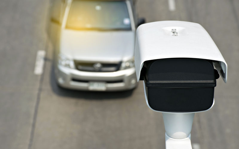
DNIT Traffic Tickets Processing and Management
The EGL Engineering, in a joint venture with two other companies, holds the largest contract in Latin America for traffic violations processing.
Actions and results
Establishment of a General Coordination in charge of planning, organization, management, supervision and advice to teams and activities that make up the whole cycle of traffic violations processing. It is made up by a multidisciplinary team including law specialists in the field of traffic inspection, systems analyst, administrators, archivists, journalists, among others.
Development of Traffic Engineering studies by a team made up by technicians and civil engineers tasked with: processing and analysis of information from grading volumetric counts, vehicle speed records, vehicle weighing records and road accidents; support to the management and control of traffic surveillance equipment; technical studies of installation/monitoring, gauging, shutdown and cancellation of traffic surveillance equipment; processing of the daily average volumes – VMD calculation and of road accident severity indexes; development of statistical and specialized reports on traffic engineering.
Monitoring of systems used throughout the violations processing performed by a team of developers, system and database analysis in charge of: requirements, proceedings and use cases; monitoring and analysis of systems implementation, integration, upgrade and performance; specialized and statistical reports; creation of portals/applications; communication with systems integrated to the processing of infractions, such as RENAINF, RENAVAM, Post Office, Data Warehouse and Business Intelligence, and interfaces with traffic surveillance equipment operators; organization of issuance of documents for printing; audit of systems or technological environment of companies hired for electronic supervision.
Proceedings Analysis and Fact Finding by teams of technicians and bachelors in law in charge of the analysis and fact finding for proceedings to find the actual offender; defense of the sanction, appeals at the court of second instance and request for enforcement of a written warning penalty; prescription and cancellation of violation notices; untying of violation notices and reimbursement of fines; Law on Access to Information – Law No. 12,527, of November 18, 2011, and its amendments; proceedings from the Justice, Public Prosecution and Control Agencies; registration of credits/debtors in credit protection systems, Active Federal Debt, CADIN, SIAFI, among others established by the DNIT. It has already analyzed and carried out the fact finding stage for over 890,000 proceedings.
Support to the Administrative Boards of Traffic Violation Appeals – JARI, provided by technical teams and bachelors in law. It is aimed at providing administrative support, support the analysis and fact finding of proceedings of Appeal in Courts for First and Second Instances, and elaboration of official documents resulting from Appeals judgment activities.
Reading and Verification of images recorded by the electronic traffic inspection equipment, vehicle plate typing and conference of the data of the breaching vehicle, re-analysis of the image checked and recorded as invalid, and on the obliteration of the driver and passengers of the breaching vehicle. It has already checked over 18,000 images.
Treatment and Digitalization of Documents upon the receipt, classification, digitalization, indexation and storage of documents produced by the traffic inspection. It has already handled and digitalized more than 830,000 documents.
Printing of traffic notifications such as sanctions, penalty and appeal decision, and other documents related to the traffic inspection activity performed. It has already printed more than 10,000 documents.
Services and Protocol that delivers on-site services to citizens at the DNIT superintendence offices regarding the traffic notification process, and reception, protocol and processing of documents. It allotted 27 teams in the 26 states and the Federal District.
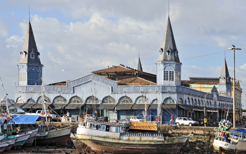
Belem – PA BRT Operational Structuring
Actions and results
- Improvement and rationalization of the operational services plan.
- Specification of fares and operational integration between different services, fare calculation study for each service to be assigned and economic feasibility studies.
- Intelligent Transport Systems (ITS) specification, including electronic ticketing and Operational Control Center (CCO) for the trunk-feeder system, including forecast of the BRT Belem – waterway transportation integration. Assessment of the designed corridor capacity through micro simulation of the corridor operation, including impact analysis of the operation combined with the metropolitan BRT.
- Preparation of minutes to review the municipal institutional structure, as well as guidelines for future integration with the Metropolitan BRT corridor.
- Elaboration of specifications for standard urban river vehicle.
- Consolidation of studies, and preparation of the Bidding Documents (concession notice, basic designs and other annexes).
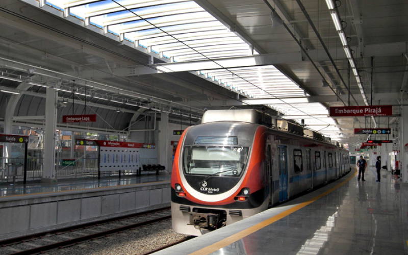
Technical Studies for the PPP of Metro Salvador – Bahia
Actions and results
- Elaboration of demand scenarios.
- Proposals of institutional and management model.
- Drafting of fare policy guidelines and financial management.
- Preparation of architectural design for the stations.
- Implementation of recommendations to the functional design.
- Support to the granting authority in the evaluation of projects submitted to the Manifestation of Interest Process, to select the proposal to be implemented.
- Participation in the Notice consolidation and support to clarifications arising from the public hearings held.
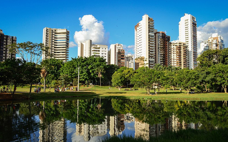
Audit to the Concession of the Anhanguera Portion LRV, Goiania – GO
Actions and results
- Technical audit of all volumes presented in the studies:
- Demand projections and estimates.
- Supply studies and estimates.
- Assessment of the layout defined to the LRV Anhanguera.
- Assessment of stations, stop points and redevelopment proposed to the Anhanguera Portion.
- Analysis of infrastructure, rolling stock and proposed construction methods for the implementation of the LRV.
- Evaluation of road circulation as of the LRV implementation.
- Evaluation of the LRV operational guidelines.
- Analysis of the proposed Performance Appraisal model.
- Analysis of operating costs, expected revenue and business plan.
Value for Money. - Analysis of funding and guarantee sources for public and private investments.
- Evaluation of the proposed risk matrix.
- Evaluation of the service concession model.
- Drafting of compliance assessment report
- Proposed adjustments
Modeling of the Roraima Intercity Transportation – RR
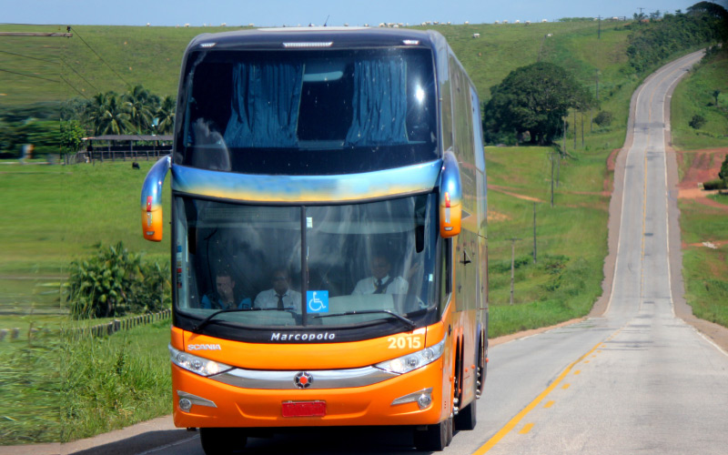
Actions and results
- Survey and evaluation of existing data.
- Field surveys: opinion and satisfaction pools with users and non-users for qualitative assessments of terminals and stop points; origin and destination research; passenger counting on the roads; research on information transportation origin and destination; up and down survey; volumetric traffic count of informal transportation on the main accesses to the municipality of Boa Vista.
- Diagnosis of the current system.
- Elaboration of system restructuring proposal: modeling, economic studies and system feasibility studies; simulation and scenario analysis for the respective demands and supplies forecasts, also considering the current system modeling and simulation.
- Elaboration of the draft Concession agreement.
- Specification of the technology package to the monitoring system including an Operational Control and Monitoring Center and Electronic Ticketing.
- Basic structuring of regulatory agency for the intercity transportation of passengers.
- Structuring of the assignation process of intercity passenger transportation by share-a-ride taxi.
- Analysis and proposal of standard infrastructure to the main stop points of the intercity passengers’ transportation system.
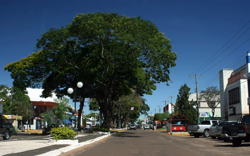
Ponta Porã Urban Mobility Plan – MS
Actions and results
- Preliminary analysis of mobility through discussion and analysis of existing data.
- Field survey:
- Domestic origin and destination;
- Classified vehicles counting;
- Screen and Cordon Line);
- Frequency and Visual Occupation of public transportation;
- Traffic Speed and Delay on the major corridors;
- Pedestrian and Cyclist Counts on main intercessions;
- Opinion about Public Transportation.
- Registration and characterization of the road system, sidewalks, road signs (horizontal, vertical and semaphore), bus stops and electronic surveillance equipment. Information was mostly extracted from the CTM through the Territorial Information System – SIT, both implemented by the EGL Engineering.
- Preparation of the Mobility Information Database (BIMob), based on information supplemented through surveys and inventories and on the society’s opinion (public hearings).
- Elaboration of the Diagnosis of the Ponta Porã Urban Mobility System supported by computer tools for the macro simulation of transportation networks and indicators of the Sustainable Urban Mobility Index (IMUS).
- Elaboration of the Urban Mobility System Forecast considering future scenarios composed by short-term (5 years), medium-term (10 years) and long-term (15 years) forecasts, assisted by computer tool for macro simulation of transportation network and indicators of the IMUS.
- Proposal of guidelines, plans, basic designs, interventions and actions on each specific theme, as well as priority investments in mobility, assisting the City Hall in the selection of the PlanMob proposals and investments;
- Consolidation in a single document, the Ponta Porã PlanMob.
- Promote the internalization of knowledge in the city hall, by training municipal technicians to disseminate the applied methodology, and share technical content.
Road Engineering Projects to the Macapá Public Transportation System – AP
Actions and results
- Characterization of the municipality through the search (on primary and secondary database) of information and data on population, socioeconomics, education, climate, relevant legislation and current projects.
- Cadastral survey of the main forms of occupation and use of the city in the area under study, pm proposed corridors and the routes indicated for the implementation of bicycle paths.
- Identification of paving, sidewalk status, accessibility conditions, street lighting, drainage and urban equipment in the vicinities of corridors and main passenger embarkation and disembarkation points in the study area.
- Survey of public transportation system information including registration of lines, routes, current studies and projects, registration of fleet and safety.
- Field survey: embarkation and disembarkation of the main bus lines; classified vehicles count; frequency and visual occupation of collective transportation; traffic speed and delay; count of cyclists on the main intersections; and, opinion on collective transportation.
- Registration and characterization of the road system, sidewalks, road signs (horizontal, vertical and semaphore), bus stops and electronic surveillance equipment.
- Collection of information and statistical data on the incidence of accidents involving pedestrians and cyclists in the area under study, and inside public transportation vehicles (theft, robbery, etc.).
- Functional simulation of the mass transportation system concept (current and proposal).
- Topographic surveys – planialtimetric and altimetric, geotechnical and hydrologic studies.
- Preparation of draft and executive architectural projects: walkways; sidewalks; operation inspection center; urban equipment and street furniture; landscaping.
- Preparation of draft and executive projects of road, civil and special art works: geometric; draining; earthmoving; paving; signaling; bicycle path; public lighting; structural and installations projects.
- Preparation of complementary plans comprising operation and maintenance, environmental control and matching.
- Preparation of budget and full specifications and calculations.
- Proposal on the Notice Minute and Term of Reference to hire envisaged infrastructure works and other civil and architecture works.

Civil Works and Postures License and Inspection System, Rio de Janeiro – RJ
Actions and results
The product of the analyses will enable different users to view data and information no longer in an isolated way, as happens today, but also in an integrated way related to some geographical element such as a street, neighborhood, administrative region, slum. The GeoSISLIC encompasses several business models. Each module is made up of a set of its own features, compliant with a given user profile. These are: Operational Module; Analysis Module; Administration Module; Legacy Treatment; and, Managerial Information.
- Survey of functional and non-functional requirements
- Definition of business rules to the Operational Module
- Definition of business rules in Legacy Treatment
- Definition of the system architecture
- Database modeling
- Specification and implementation of the ETL (Extract, Transform and Load) routines
- Specification and implementation of OLAP Cubes
- Prototyping of the system screens and features
- Modules development and implementation
- Delivery of training and technology transfer
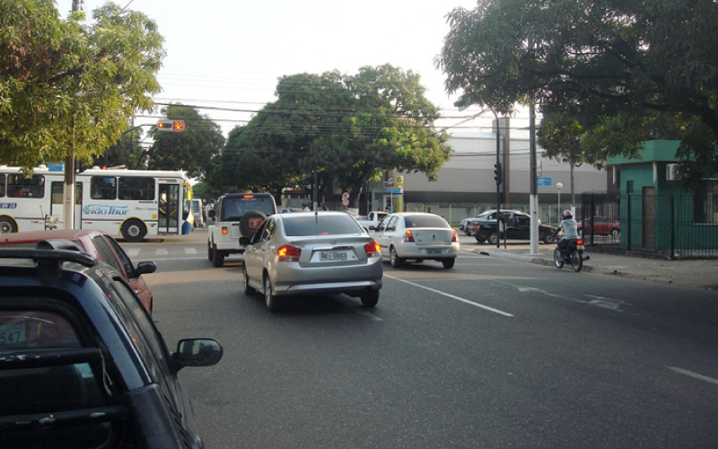
Traffic Impact on Real Estate Developments
Actions and results
- Characterization of the road system
- Evaluation of the urban aspects of the area and the conditions of accessibility and urban mobility.
- Individual survey and registration of occupation of lots and buildings in the region under analysis.
- Building of the transportation network simulation environment.
- Survey on volumetric counts on 10 stations, and screen and cordon line surveys.
- Preparation of the Origin and Destination Matrix for the region under analysis (75 areas).
- Assembly of geographic databases in Geographic Information System for urban transportation (TransCard).
- Preparation and calibration of the travel distribution model.
- Forecast of future transportation demand.
- Simulation of three scenarios, situation with and without the undertaking, varying occupation and considering measures to mitigate the identified impacts.
- Analysis of the results found in terms of capacity, service levels, physical-operational and urban conditions, conditions of public transportation service offerings.
- Elaboration of proposals for measures to mitigate the impacts identified including geometric designs of intersections with semaphore, semaphore designs, adaptation of roundabouts, expansion of road capacity and urban development guidelines.
- Assessment of the DER supplementary requests after the study submission.
- Saturation analysis of the affected road system with micro simulation of the intersections evaluated using the VISSIM software.
- Quantification of resulting impacts, and proposal of new mitigating or compensatory measures
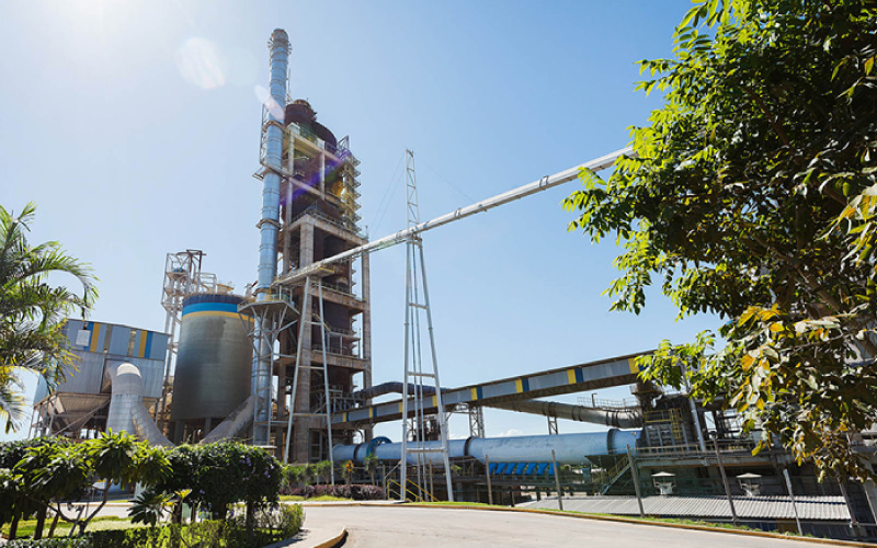
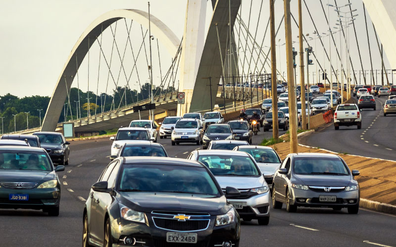
Impact on Traffic for industrial hubs
Actions and results
- Modeling of traffic generation from the implementation of the cement industry and its impacts on the region under direct influence.
- Quantification of solid residues resulting from the increased heavy vehicles fleet.
- Recommendation of routes to outflow the production of the cement plants.
- Calculation of the general capacities of the road system in the area under direct influence of the undertaking.
- Analysis of saturation levels on affected intersections or intersections affected by the production outflow.
- Analysis of traffic currents, signs and movement of pedestrians and persons with reduced functional mobility and users of public transportation systems.
- Analysis of accesses and parking lots envisaged in the project to implement the plant.
- Recommendation of impact mitigation measures, geometric and signaling solutions necessary to mitigate the effects of trip generation to the area of influence.
Multi-purpose Technical Registration, SIT and PGV in Mossoró – RN
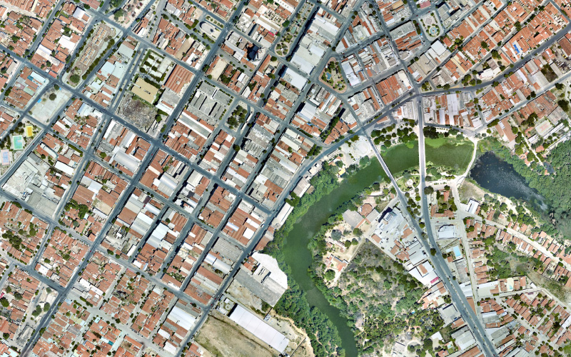
Actions and results
- Elaboration of Cadastral Reference Plant – PRC in the scale 1: 5000.
- Specialized technical audit of the digital map and orthophotos provided by the city hall.
- Elaboration of Individual blocks design in the scale 1: 1000.
- Registration and registration renewal of real state and street furniture data, with photographic survey of the properties’ facades.
- Owners’ registration renewal;
- Registration and registration renewal of infrastructure data, such as: information survey about the sewerage, rainwater system and telephone network, paving, signaling, sidewalks and street furniture;
- Update and calculation of the built area of properties to charge the IPTU tax.
- Identification and registry of invaded and unlawful areas;
- Corporate databases modeling to implement the Multi-purpose Technical Registry.
- Implementation of the Georeferenced Territorial Information System.
- Survey of complementary requirements to customize the Georeferenced Territorial Information System of the Multi-purpose Technical Registry (CTM).
- Capacity-building and transfer of knowledge to the municipal team.
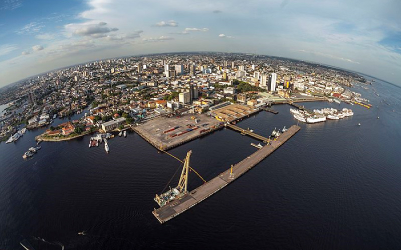
Multi-purpose Registry, SIT and Readdressing in Manaus – AM
It has also performed Readdressing (Legal Address Project) activities to correct any inconsistency on the municipal addresses and numbering.
Actions and results
- Aerophotogrammetric survey to generate orthophoto.
- Design and geocoding of the Urban Digital Map through stereoscopic restitution.
- Urban registration and registration renewal: real estate and street furniture registration.
- Calculation of the real estates area.
- Development and implementation of the Geographic Information System (SIG) comprising the modules of Finances (real estate and street furniture registration), PEL (Legal Address Project) and Programs and Certificates.
- Training to and capacity-building of municipal technicians.
Multi-purpose Technical Registry, SIT and Land Management, Rio Verde – GO
Promotion of the modernization of municipal urban management through the implementation of the Multipurpose Technical Registry (CTM) and the Territorial Information System (SIT). The project’s objective is to ensure that municipal registries are updated and consolidated in a corporate database so that data and information are integrated and shared by the various municipal secretariats.
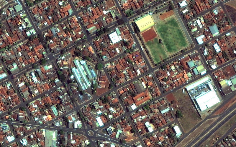
Actions and results
- Satellite Image Acquisition (Orthophoto)
- Drone flight to map specific areas
- Elaboration of digital map through the image tracing of the main geographic layers
- Incorporation of geographic databases into the new digital map
- Geocoding of the georeferenced map to the several sector-specific registries;
- Development of georeferenced and automated individual Blocks Plant;
- Elaboration of Cadastral Reference Plant (PRC) in the scale 1: 5000.
- Renewal of real state, street furniture and urban infrastructure registry
- Update of built area to update the IPTU tax
- Drafting of the new Addressing Project
- Promotion of Land Regularization based on the Federal Law 13,465 of 2017
- Differentiation between REURB-S and REURB-E Regularization Projects
- Preparation of Urban Technical Specifications by Neighborhood
- Elaboration of individual Technical Specifications by real estate
- Implementation of Territorial Information System consisting of 5 basic modules and 5 additional modules. The additional modules comprise: Generic Values Ground Plan, Economic Development, Land Management and Public Asset, Managerial Consultations and Spatial Analysis and BI (OLAP and Data Warehouse)
- Survey of requirements, preparation of technical documentation to the Term of Reference of 15 future modules defined by the municipality
- Development of integration mechanisms between the SIT and current municipal systems
- SIT users capacity-building
- Advice and assisted operation to the municipal team after project completion
Multi-purpose Technical Registry, SIT and Master Plan in Ponta Porã – MS
Actions and results
- Updated orthophoto acquisition
- Georeferenced mapping of urban occupation (actual situation map)
- Matching of the urban occupation map and the fiscal map
- Geocoding of the georeferenced map to the several sector-specific registries
- Registration renewal for real estate, economic activities and urban infrastructure and services, with photographic survey of facades and road sections
- Development of georeferenced and automated individual Blocks Plant
- Elaboration of Cadastral Reference Plant (PRC) in the scale 1: 5000
- Update of the real estates’ built area to charge the IPTU tax
- SIT implementation covering registration OF real estate modules and economic activities, urban infrastructure, basic navigation, system administration, people, education, health, and land management
- Training of the new system key users
- Use of the MTC to update the Municipal Master Plan and draft the Urban Mobility Plan
- Update of the Generic Values Ground Plant
- Update of the Tax Code
- Service to citizen
Contact Us
Contact us for a free diagnosis and recommendations on preliminary actions.
Address
Complex The Union
SMAS Trecho 3 Conj. 3 Bloco A Sala 215 Brasília-DF
CEP: 70.610-635
It is located in a business complex, which allows holding small, medium and big events.
Phones
+55 (61) 3032-6303 | (61) 3248-1811
---EGL")